
Trekking to Goechala: A Complete Guide from Yuksom to the Heart of Kanchenjunga

Updated: Aug 2
The Goechala Trek is one of India's most popular high-altitude adventures, revered for its raw wilderness, close-up views of Mt. Kanchenjunga, and an immersive journey through the mystical landscapes of West Sikkim.
Starting from the historic village of Yuksom, this demanding trail winds through ancient forests, alpine meadows, and glacial moraines, culminating at Goechala Viewpoint 1, an awe-inspiring vantage point that places you just across the face of the world's third-highest mountain.
Unlike conventional tourist routes, the Goechala Trek is not accessible by vehicle. It is an expedition that demands physical preparation, logistical planning, and support from local travel agencies that provide experienced guides, porters, cooks, and camping equipment. Trekkers must rely entirely on tented accommodation and pre-arranged food supplies with no hotels, restaurants, or infrastructure on the route.
This trek will test your endurance. But it gives you communion with nature and opens a window into Sikkim's cultural and ecological heritage.
Historical Background: Origins of the Goechala Trek Route:
Before it became a trekker's destination, the route existed only for ancestors to take their cattle to the mountains in the warm season, likely the monsoon, and bring them down in the cold, likely winter.
The history of the Goechala Trek traces back to early Himalayan exploration efforts in the 19th and 20th centuries.
In their quest to study and chart the Eastern Himalayas, British explorers and surveyors identified this route as a natural corridor to observe the Kanchenjunga massif from its eastern flank.
Local communities, particularly the Lepchas, Bhutias, Tshongs, the Limboos and General Nepali communities, were instrumental in guiding these early expeditions.
Their deep knowledge of the terrain, weather, and sacred geography helped shape the trail that is now widely recognised as the Goechala route.
Over time, this trail evolved into a popular trekking route, especially after the 1970s, when Indian and foreign mountaineers began using it for Kanchenjunga base camp expeditions.
Sikkim's forest department and tourism authorities gradually formalised the route, introduced permits, and promoted eco-tourism, ensuring that the trek remains sustainable and respectful to the fragile alpine ecosystem.
Today, the Goechala Trek stands as a symbol of Sikkim's adventure tourism, drawing serious trekkers from around the globe who seek natural grandeur and cultural depth.
Goechala Trek Itinerary :
The Goechala Trek spans 10 days, beginning in Yuksom and progressing through dense forests, alpine meadows, and high-altitude glacial terrain. Below is the day-by-day itinerary, complete with campsite altitudes and estimated trekking durations.
Day 1: Arrive at Yuksom (1,780 m)
Accommodation: Limboo Homestay, Yuksom
Arrive at Yuksom, a historic town in West Sikkim and the base for the Goechala Trek. This day is reserved for acclimatization and final preparations. You will meet your local trekking team, check your gear, and explore nearby cultural landmarks such as the Norbugang Chorten. Stay at Yuksom Homestay.
Yuksom was the first capital of Sikkim, established in 1642, and the Norbugang Chorten marks the spot where the first Chogyal was crowned. It is also the last point with reliable mobile network and vehicle access.
Day 2: Yuksom to Sachen (2,180 m)
Distance: ~8 km | Trek Duration: 5–6 hours
The trail slowly rises through dense subtropical forests and wooden bridges over the Pha Khola river. Expect a mix of pine, oak, and rhododendron vegetation. Sachen is a quiet forest campsite.
Day 3: Sachen to Tshoka (2,950 m)
Distance: ~7 km | Trek Duration: 4–5 hours
Ascend steeply via the suspension bridge over the Prek Chu River and climb the switchbacks to reach Bakhim, then proceed to Tshoka, a beautiful meadow campsite with panoramic views of Mt. Pandim.
Day 4: Tshoka to Dzongri (4,020 m)
Distance: ~9 km | Trek Duration: 5–6 hours
A demanding day as you ascend through misty rhododendron forests and rocky terrain. Stop briefly at Phedang (3,650 m) before pushing onward to Dzongri, a vital acclimatization point on the trek.
Day 5: Acclimatization at Dzongri
Activity: Early morning hike to Dzongri Top (Dafhla Gang, 4,200 m) for sunrise view of Kanchenjunga.
Return to Dzongri for breakfast. After rest, trek to Dzongrila Pass and return. This day is crucial for altitude adaptation and photography.
Dzongrila Pass sits at around 4,400 m. The Dzongri Top panorama covers Kanchenjunga, Kabru, Rathong, Koktang and Pandim in a single sweep.
Day 6: Dzongri to Thangsing (3,800 m)

Distance: ~10 km | Trek Duration: 5 hours
Descend to Kokchurung, then climb along the Prek Chu river valley to reach Thangsing. This scenic valley is flanked by snow-capped peaks and makes for a stunning campsite.
Day 7: Thangsing to Lamuney (4,200 m)
Distance: ~4 km | Trek Duration: 2 hours
This is a short, high-altitude stretch that plays a vital role in the overall trek strategy. The route gradually ascends through a barren, rocky valley flanked by towering peaks like Mt. Pandim.
Although the distance is minimal, the elevation and reduced oxygen levels can make the walk slower. Lamuney serves as the last established campsite, allowing trekkers to rest, rehydrate, and prepare for the early morning ascent to Goechala Viewpoint 1 the following day.
Day 8: Lamuney to Goechala Viewpoint 1 (4,650 m), then to Kokchurung (3,700 m)
Distance: ~14 km | Trek Duration: 8–9 hours
Begin pre-dawn to reach Goechala Viewpoint 1, catching the sunrise over Kanchenjunga.
The push begins between 1 AM and 3 AM by headlamp. On the way you pass Samiti Lake (4,300 m), a sacred glacial lake that holds the reflection of Mt Pandim on a still morning. Timing matters here. The sun warms the valley soon after dawn, clouds build fast, and trekkers who arrive late often see only fog.
After a brief stop, descend to Lamuney for breakfast, then proceed further down to Kokchurung to shorten the return path.
Day 9: Kokchurung to Tshoka (2,950 m) via Phedang
Distance: ~16 km | Trek Duration: 7–8 hours
Take the alternate forest trail from Kokchurung to Phedang, bypassing Dzongri. Dense forest paths, silence, and solitude dominate this day.
Day 10: Tshoka to Yuksom (1,780 m)
Distance: ~15 km | Trek Duration: 6–7 hours
Retrace your steps via Bakhim and Sachen to return to Yuksom. This marks the conclusion of your high-altitude Himalayan adventure.
Goechala Trek Height – How High Do You Go?
The Goechala Trek height reaches its maximum elevation at Goechala Viewpoint 1, which stands at an altitude of roughly 4,650 meters (15,256 feet) above sea level. This viewpoint offers one of the closest and most dramatic views of Mt. Kanchenjunga (8,586 m), the third-highest mountain in the world.
While the original Goechala Pass lies deeper and closer to the actual base of Kanchenjunga, trekkers are now only allowed to proceed up to Viewpoint 1 due to conservation and security regulations. Even so, this altitude is substantial and demands thorough acclimatisation and fitness.
Why 4,650 m and Not 4,940 m?
The actual Goecha La pass sits at 4,940 metres (16,207 feet). Until 2016, trekkers could continue past Viewpoint 1 to Viewpoint 2 and on to the pass itself.
That changed in spring 2017. The Khangchendzonga National Park authority closed the section beyond Viewpoint 1 and the rule is strictly enforced. Two reasons are given. Camera traps recorded snow leopard activity around Viewpoint 2, and the glacial moraine beyond the viewpoint is unstable and dangerous without technical gear.
This is why you will still see some websites listing the Goechala Trek height as 16,200 feet. They are quoting the old pass altitude, not the trek. The highest point you can legally reach today is Goechala Viewpoint 1, also called Sunrise Point, at about 4,650 metres.
⚠️ If an agency promises to take you past Viewpoint 1, walk away. They are either lying or planning to break park rules with you in the group.
Key Altitudes Along the Goechala Trek:
Location | Altitude (Meters) |
Yuksom | 1,780 m |
Sachen | 2,180 m |
Tshoka | 2,950 m |
Dzongri | 4,020 m |
Dzongri Top | 4,200 m |
Thangsing | 3,800 m |
Lamuney | 4,200 m |
Samiti Lake | 4,300 m |
Goechala view point 1 | 4,650 m |
Due to the considerable elevation gain over a short period, the Goechala Trek is classified as a high-altitude trek, and altitude sickness precautions are essential.
The route includes acclimatization stops (especially at Dzongri) to mitigate risks and improve performance at higher camps.
Goechala Trek Map – Route Overview and Trail Navigation
A detailed Goechala Trek map is essential for understanding the route's geography, elevation changes, and terrain variety. The trek moves through the Kanchenjunga National Park, a UNESCO World Heritage Site known for its dense forests, glacial valleys, and remote high-altitude landscapes.

Key Points Along the Goechala Trek Route:
Yuksom (1,780 m) – Trek starting point
Sachen (2,180 m) – Forest campsite
Tshoka (2,950 m) – First views of snow-capped peaks
Dzongri (4,020 m) – Acclimatization zone
Dzongri Top (4,200 m) – Sunrise viewpoint
Thangsing (3,800 m) – Meadow campsite below Mt. Pandim
Lamuney (4,200 m) – Final push before summit
Samiti Lake (4,300 m) – Sacred glacial lake on summit day
Goechala Viewpoint 1 (4,650 m) – Final altitude
Kokchurung (3,700 m) – Forest descent trail
Phedang (3,650 m) – Connects Kokchurung to Tshoka
Trail Highlights on the Map:
● Total Distance: ~90 kilometers (round trip)
● Total Duration: 10 days
● Trail Type: Out-and-back with partial loop via Kokchurung-Phedang alternate route
● Entry/Exit Point: Yuksom
While physical trail maps are available from local agencies in Yuksom, trekkers are encouraged to use offline GPS tools or obtain a topographic trekking map of the Kanchenjunga region. However, note that mobile network coverage is unavailable beyond Yuksom.
Pro Tip: Local guides carry trail knowledge passed down over generations, which often proves more valuable than GPS when weather conditions obscure the path.
Samiti Lake – The Sacred Lake on the Goechala Trail
Samiti Lake sits at roughly 4,300 metres, between Lamuney and Goechala Viewpoint 1. It is a small glacial lake, fed by snowmelt, and it is considered sacred by local communities.
Trekkers reach it in the dark on summit day. On the way back down in daylight, the water turns still and mirrors Mt Pandim and the ridgelines around it. It is one of the most photographed spots on the whole trail.
Things to know:
● Camping beside the lake is no longer allowed. Lamuney is the last permitted campsite.
● Do not wash, bathe or leave anything at the lake. It is a sacred site and a protected water source.
● The lake often freezes over between December and March.
✅ Pro Tip: Save your photos of Samiti Lake for the descent. On the way up it is pitch dark, and on the way down the light is perfect.
Wildlife and Forests on the Goechala Trail
The trail crosses five ecological zones in ten days. Subtropical forest, humid jungle, rhododendron belt, alpine meadow, and glacial moraine. Few treks in India pack that much variety into one route.
Trees and flowers: Oak, maple, chestnut and pine fill the lower forest. Above Bakhim the rhododendrons take over. Magnolias and wild orchids appear along the Sachen and Tshoka stretch in spring.
Animals: Khangchendzonga National Park shelters the Red Panda, Sikkim's state animal, along with the Himalayan Black Bear, Himalayan Tahr, Blue Sheep and the snow leopard. Sightings are rare. The animals hear you long before you see them.
Birds: Over 250 species have been recorded in the park. Look for the Blood Pheasant, the Himalayan Monal and high altitude thrushes around Tshoka and Dzongri at first light.
✅ Pro Tip: Walk quietly and start early. The first hour after sunrise is the only realistic window for wildlife on a busy trail.
🚫 Leave No Trace is not optional here. Everything you carry up comes back down with you, including wrappers and batteries.
Goechala Trek Difficulty – How Challenging Is the Trail?
The Goechala Trek difficulty level is rated as moderate to difficult, making it suitable only for trekkers with prior high-altitude experience or a strong baseline of physical fitness. This is not a leisure hike, it is a serious Himalayan expedition demanding preparation, resilience, and support from a well-equipped local trekking agency.
Why Goechala is Considered a Difficult Trek:
● It is difficult, not technical. You do not need mountaineering skills, ropes, crampons or climbing gear. The challenge is altitude, distance and cold, not technical terrain.
1. High Altitude Challenges:
● Maximum altitude: 4,650 meters at Goechala Viewpoint 1
● Rapid elevation gain over a short distance increases the risk of Acute Mountain Sickness (AMS)
● Untreated AMS can progress to HAPE (fluid in the lungs) or HACE (swelling of the brain). Both are medical emergencies and both require immediate descent.
● Carry a pulse oximeter. Report headache, nausea or breathlessness to your guide the moment you feel it, not the next morning.
● The Tshoka to Dzongri stage gains over 1,000 metres in a single day. Standard mountaineering practice is to sleep no more than 300 to 500 metres higher than the night before. This one day breaks that rule badly, which is exactly why the Dzongri rest day is not optional.
● Cold temperatures, especially from Dzongri onwards, can drop well below freezing at night
2. Length and Duration
● 90 km round-trip covered over 10 days
● Long trekking hours (5 to 8 hours per day) over varied terrain
● Summit day is the hardest by a distance. You start between 1 AM and 3 AM, walk around 14 km, and gain then lose serious altitude in freezing dark.
3. Remote Terrain
● No access to roads, hotels, or restaurants once the trek begins
● Dense forests, snow-covered sections, and glacial moraines demand careful navigation
● Beyond Dzongri, evacuation options are very limited. Getting a sick trekker down takes hours or days on foot, not minutes by road.
4. Self-Sufficiency Requirement
● You cannot do the Goechala Trek solo
● Trekkers must hire registered local travel agents who will organize permits, guides, porters, cooks, pack animals, tents, and meals
5. Weather Extremes
● Sudden rain or snowfall can occur even in trekking seasons
● Trails may become slippery or blocked, requiring rerouting
Recommended Fitness Level:
● Ability to walk 10 to 15 km daily with a 5 to 6 kg backpack
● Prior experience with multi-day Himalayan treks preferred
● Cardiovascular endurance, core strength, and stamina are critical
⚠️ Caution: Goechala Trek is not for beginners or casual tourists. Without professional support, this trek can become dangerous very quickly due to isolation and unpredictable weather.
Goechala Trek Best Time – When Should You Plan the Trek?
The best time to do the Goechala Trek is during the pre-monsoon (spring) and post-monsoon (autumn) seasons. These windows offer stable weather, clear mountain views, and safe trail conditions, vital for a high-altitude trek like Goechala.
Ideal Trekking Seasons:
1. Spring Season: Mid-March to Mid-May
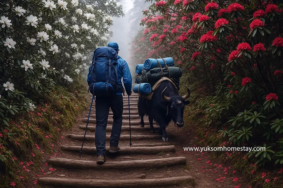
Pros: Boom! The rhododendrons explode into their annual riot of colour, transforming the once-sombre woodland into nature's own psychedelic light show. Walk beneath them and surrender to their temporary, intoxicating empire of colour.
Clear skies in the early morning hours with breathtaking sunrise views from Dzongri Top and Goechala.
Moderate daytime temperatures
Considerations: Trails can be wet from melting snow at higher altitudes.
Be prepared for cold nights, especially above 3,500 m.
2. Autumn Season: Mid-October to Late November
Pros: Crisp, dry air and excellent mountain visibility
Stable trail conditions once the monsoon has fully cleared
Minimal risk of heavy snowfall before late November
Considerations: Nights are colder compared to spring
Foliage is less vibrant, but landscapes remain dramatic
Why We Do Not Recommend September, and Why Most Websites Get This Wrong
Almost every trekking website lists September as the start of the autumn season. From where we sit in Yuksom, that is wrong.
September is the wettest month we get. It is September rain, not July or August rain, that brings down the landslides and does the real damage on these hills. We have watched it happen year after year.
The rain often carries into the first week of October.
Booking a September departure means paying for a trek with a high chance of blocked trails, washed-out sections, leeches in the lower forest, and no view of Kanchenjunga when you finally get to the top.
Wait for the rain to finish. Mid-October is when the sky actually clears.
What About December?
Early December can still work, but the odds start turning against you. After mid-December the cold at Lamuney and above makes reaching Goechala Viewpoint 1 unlikely. Groups turn back.
If December is your only window, do the Dzongri Trek instead. It is lower, shorter, and the Kanchenjunga sunrise from Dzongri Top in clear December air is one of the finest views in Sikkim. You get a real trek instead of a failed summit attempt.
Months to Avoid:
Mid-May to Early October (Monsoon): Heavy rainfall, leech-infested trails, landslides, and poor visibility. September is the worst of it.
Mid-December to February (Winter): Sub-zero temperatures, heavy snowfall, and trail closures beyond Dzongri
✅ If your goal is photography and peak visibility, choose late October.
✅ If you want to witness Sikkim's floral beauty, opt for April.
✅ If December is your only window, choose the Dzongri Trek.
Goechala Trek Temperature – How Cold Does It Get?
Cold is the part most trekkers underestimate. Daytime walking is comfortable. Nights above 3,500 m are not.
Season | Daytime | Night at Higher Camps |
Spring, March to May | 12°C to 15°C | 0°C to -3°C |
Autumn, mid-October to November | 8°C to 12°C | -5°C to -10°C |
Winter, mid-December to February | Below freezing most of the day | Well below -10°C |
Dzongri, Thangsing and Lamuney are the coldest camps. Summit morning at Viewpoint 1 is colder still, with wind chill on an exposed ridge before sunrise.
⚠️ A sleeping bag rated to -10°C is the minimum for autumn. Ask your operator what rating they supply before you book.
Goechala Trek Distance – How Far Will You Trek?
The total Goechala Trek distance is approximately 90 kilometers (round trip), covered over a span of 10 days. This includes ascending from Yuksom (1,780 m) to Goechala Viewpoint 1 (4,650 m) and descending back through a partial alternate route.
Distance Breakdown by Day:
Day | Route | Distance | Trek Duration |
Day 1 | Arrival at Yuksom | Rest day | Acclimatization |
Day 2 | Yuksom to Sachen | ~8 km | 5 to 6 hours |
Day 3 | Sachen to Tshoka | ~7 km | 4 to 5 hours |
Day 4 | Tshoka to Dzongri | ~9 km | 5 to 6 hours |
Day 5 | Dzongri Top and Dzongrila Pass | ~7 km | 4 to 5 hours |
Day 6 | Dzongri to Thangsing | ~10 km | 5 hours |
Day 7 | Thangsing to Lamuney | ~4 km | 2 hours |
Day 8 | Lamuney to Goechala Viewpoint 1 to Kokchurung | ~14 km | 8 to 9 hours |
Day 9 | Kokchurung to Tshoka via Phedang | ~16 km | 7 to 8 hours |
Day 10 | Tshoka to Yuksom | ~15 km | 6 to 7 hours |
Total | Yuksom to Goechala and back | ~90 km | 10 days |
Trail Characteristics:
The trek is long, but daily segments are well-balanced to allow acclimatization and rest
● Terrain includes forest trails, stone paths, ridges, and glacial sections
● Steep climbs are concentrated between Sachen–Tshoka and Tshoka–Dzongri
⚠️ Note: The return journey includes a shorter alternate descent route via Kokchurung to Phedang, which helps avoid retracing the full climb to Dzongri.
Goechala Trek Price – What Does the Trek Cost?
As of 2026, the Goechala Trek price ranges from ₹21,000 to ₹35,000 (INR) per person for the Yuksom to Yuksom trek, on a group basis. Permit fees, staff wages and supply costs have all been revised upward over the last few seasons, so older figures you find online no longer hold. For international trekkers the cost is higher, because of additional permits and paperwork.
This is not a trek where you pay for a hotel and hire a cab. The price reflects the logistics involved in organizing a remote, self-sufficient expedition through the Kanchenjunga National Park.
This Is a Group Rate, Not a Solo Rate
This is the single biggest misunderstanding about Goechala pricing, and it causes real friction between trekkers and agents every season.
The figure above assumes you are walking as part of a group. It is not what one person pays.
A Goechala trek needs a guide, a cook, kitchen helpers, mules and their handlers, a kitchen tent, a full supply run and a complete set of permits, whether one person walks the trail or ten. None of that shrinks because you are alone. It simply gets divided among fewer heads.
Group Size | Approximate Cost Per Head |
Solo trekker | ₹1,00,000 and above |
2 trekkers | ₹75,000 to ₹85,000 per head |
Group, trek only, Yuksom to Yuksom | ₹21,000 to ₹35,000 per head |
Group, including Yuksom stay and cab transfers | Up to ₹45,000 per head |
⚠️ Read every quote carefully. If you see ₹21,000 anywhere, including on this page, read it as a per head group rate. If someone quotes that figure to a solo trekker, they either have a group to place you in or they have not understood your question. Ask directly: is this per head, and how many people is it based on?
What Are You Actually Paying a Travel Agent For?
Trekkers often look at the number and think it is steep. It stops looking steep the moment you see the list of what somebody else is arranging on your behalf.
A local travel agent takes on every one of these headaches:
● Permits. Khangchendzonga National Park entry, police verification at Yuksom, and the additional clearances foreign nationals need. Filed, followed up and collected for you.
● Staff. A licensed guide, a cook, kitchen helpers, and mule handlers, all paid, insured where applicable, and fed for the full ten days.
● Mules and pack animals. For shared load, kitchen equipment and supplies.
● All food. Every meal, every day, plus tea and snacks, bought in Yuksom and carried up. There is nowhere to restock once you start walking.
● Camping equipment. Tents, sleeping bags, mattresses, kitchen tent, cooking gear, fuel, and toilet tents.
● Logistics and emergency backup. Route decisions, weather calls, and the ability to get you down fast if something goes wrong.
Not include:
your personal trekking gear.
Jackets, thermals, clothing,
trekking shoes are yours to bring.
If you do not own them, several shops in Yuksom sell gear at reasonable rates, (You may run into size problem). for best check at Silliguri or Gangtok.
Some agents also include one or two nights of hotel or homestay in Yuksom on a MAP plan, which covers your room plus breakfast and one other meal. Check whether your quote has this in it, because it changes the comparison entirely.
The Per Day Maths:
Split the trek cost across the days and the picture changes.
At ₹21,000 to ₹35,000 for a ten day trek, you are paying roughly ₹2,100 to ₹3,500 per day.
For that, every single day, you get three cooked meals plus tea, a tent, a sleeping bag and mattress, your share of a guide, cook, helpers and mules, all your permits, and a crew carrying and setting up everything before you arrive at camp. In a place with no road, no shop, no electricity and no signal.
That is not an expensive holiday. It is a supported expedition, and the number is doing a lot of work.
Cost Breakdown (Approximate):
Cost Component | Approximate Range (INR) | Usually Included? |
Trek package, Yuksom to Yuksom, 10 days | 21,000 to 35,000 per head, group basis | Yes |
GST | Charged as applicable | Added on top |
Permits and park entry | Part of package | Yes, arranged by operator |
Guide, cook, kitchen helpers | Part of package | Yes |
Mules and pack animals for shared load | Part of package | Yes |
Tents, sleeping bags, mattresses, kitchen gear | Part of package | Yes |
All meals, tea and snacks on trek | Part of package | Yes |
Yuksom hotel or homestay, MAP plan | Varies | Sometimes, ask |
NJP or Bagdogra to Yuksom cab transfer | Varies by vehicle and group size | Usually add-on |
Backpack offloading, per bag | Varies by operator | Usually add-on |
Personal trekking gear, jackets, shoes, poles | Rentable in Yuksom | No |
Travel insurance and emergency evacuation | Varies | No |
💡 Read the fine print. Two agencies can quote the same headline price and the final bill can still differ by tens of thousands. Before you pay any advance, ask three questions.
Is this per head or total?
How many people is it based on?
Does it include the Yuksom stay and the cab from NJP or Bagdogra?
💡 Pro Tip: Prices are more affordable, less headache, when arranged directly through local travel agencies in Yuksom. They have better logistical control, experienced staff, and faster emergency response capabilities.
Inclusions in Most Trek Packages:
● All meals (breakfast, lunch, dinner), plus tea and snacks
● Tents, sleeping bags, mattresses, kitchen equipment
● Licensed guide and all necessary permits
● Cook, kitchen helpers and support crew
● Porters, mules or yaks for carrying shared luggage
Exclusions:
● Travel to and from Yuksom (NJP, Bagdogra, etc.) Most provide you as an addon.
● Personal gear (trekking shoes, jackets, clothing, poles). Available on rent in Yuksom. (But you may face size problems).
● Insurance and emergency evacuation (strongly recommended)
● Hotel or Homestay cost (Some may arrange this as an addon, often on a MAP plan)
🚫 There are no hotels or restaurants along the trek route. Everything, food, water, tents, sleeping arrangements, is carried and managed by your support crew.
About the "Dhabas" You May Have Read About
Some websites list restaurants or dhabas at Tshoka, Dzongri and Thangsing. That is wrong, and it is the kind of claim that gets written by people who have not walked the trail.
What actually exists is a camp caretaker at one or two of the huts who may sell a few packets of snacks, some biscuits, prepare noodles, or a cup of tea. Only if they are there. Only if they have stock. In Phedang, if the camp caretakers are there, they prepare momos, but availability depends on the crowd. Please note the prices are double or triple once you cross Yukso, even for a packet of cookies.
That is not a restaurant. Do not picture anything like a roadside dhaba or a fast food counter in town. You cannot plan a meal around it, and you certainly cannot plan a day around it. Your crew carries your food, and that is the only food you should count on.
Goechala Trek Route – A Complete Trail Overview
The Goechala Trek route begins at the serene Himalayan village of Yuksom (1,780 m) and ascends through a variety of ecosystems, ranging from dense sub-tropical forests to high-altitude glacial valleys, before culminating at Goechala Viewpoint 1 (4,650 m). The route forms an out-and-back trail with a partial loop via Kokchurung and Phedang on the descent.
Key Route Highlights:
Yuksom to Sachen – The initial stretch moves through dense forests with gentle inclines and river crossings via hanging bridges.
Sachen to Tshoka – A steep section involving switchbacks and wooden staircases. First panoramic views emerge at Tshoka.
Tshoka to Dzongri – One of the toughest sections. Ascending through alpine rhododendron forests, you reach the ridge-top meadows of Dzongri.
Dzongri to Thangsing – After acclimatization, you descend to the valley and walk along the Prek Chu River.
Thangsing to Lamuney – A short but high-altitude stretch surrounded by towering peaks like Pandim and Kabru.
Lamuney to Goechala Viewpoint 1 – The final summit push begins before dawn for the most rewarding sunrise experience, passing Samiti Lake on the way. Return to Lamuney and descend further to Kokchurung the same day.
Kokchurung to Tshoka via Phedang – The descent route takes an alternate forest trail that bypasses Dzongri.
Tshoka to Yuksom – The final leg retraces the path through Bakhim and Sachen.
Route Summary Table:
Day | Segment | Altitude Reached | Terrain |
1 | Yuksom | 1,780 m | Village, road head |
2 | Yuksom to Sachen | 2,180 m | Subtropical forest, river bridges |
3 | Sachen to Tshoka | 2,950 m | Steep switchbacks, wooden stairs |
4 | Tshoka to Dzongri | 4,020 m | Rhododendron belt, rocky ridge |
5 | Dzongri Top | 4,200 m | Open meadow, sunrise viewpoint |
6 | Dzongri to Thangsing | 3,800 m | River valley, alpine meadow |
7 | Thangsing to Lamuney | 4,200 m | Barren rocky valley |
8 | Lamuney to Goechala Viewpoint 1 | 4,650 m | Glacial moraine, Samiti Lake |
9 | Kokchurung to Tshoka | 2,950 m | Forest trail via Phedang |
10 | Tshoka to Yuksom | 1,780 m | Descent through Bakhim and Sachen |
This route ensures gradual acclimatization, minimizing AMS risks while offering rich biodiversity, sacred landmarks, and unbeatable mountain vistas.
Why Book Through a Local Yuksom-Based Agency?
● Faster emergency response during weather disruptions or altitude sickness
● In-depth trail knowledge, including alternate routes
● Greater contribution to the local economy
● Ability to customise the package based on group size and fitness level
⚠️ Important: Solo trekking is not permitted. Booking through an authorised local operator is mandatory for safety and environmental preservation.
Packages range from budget (basic services, shared tents) to premium (smaller groups, better gear, communication, etc.).
Goechala Trek Permits – What You Need Before You Walk?
The entire trail sits inside Khangchendzonga National Park, a UNESCO World Heritage Site. The whole KNP axis, which covers Dzongri, Goechala, Chewabhanjyang, Singalila, Hilley and Barsey, is a designated Protected Area under Sikkim's permit regime. Nobody walks in without paperwork.
The part most websites get wrong is this. The Inner Line Permit and the Restricted Area Permit are not the same document, and they are not interchangeable. They are sequential, and each one depends on the one before it.
The Permit Chain for Foreign Nationals
Step 1: Inner Line Permit (ILP). Your entry permit for Sikkim. You arrange this yourself.
Step 2: Restricted Area Permit (RAP), the trekking permit. This is issued only after you hold a valid ILP. Your travel agent files it.
Step 3: Khangchendzonga National Park entry permit. Your travel agent arranges this as well.
In short: ILP first, then RAP, then KNP. Once the ILP is in your hand, your local travel agent takes care of the rest.
Where to Get the ILP?
If you are heading to Yuksom for the Goechala Trek, the practical option is the Melli Check Post, which sits on the route in from the Siliguri and Darjeeling side. It is issued on the spot.
The ILP is also available from:
● Indian Missions abroad, on the strength of an Indian visa
● Sikkim Tourism Offices in New Delhi and Kolkata
● District Magistrate offices at Darjeeling and Siliguri
● Rangpo Check Post, if you are entering from that side
What to carry: photocopies of your passport and Indian visa, plus two passport-size photographs. With those in order the permit is issued without delay.
Validity: 30 days initially. The State Government can extend it by a further 30 days through the FRO at Gangtok, the Superintendent of Police offices in the North, West and South districts, or online through the eFRO portal.
Rules Specific to Foreign Trekkers
● You must be a group of two or more. A single foreign trekker cannot be issued a trekking permit for the KNP axis.
● The trek must be booked through a Government-registered travel agency, with a certified guide.
● OCI holders are treated as foreign nationals for permit purposes and must obtain an RAP.
● Nepalese citizens need only their citizenship document.
Bhutanese nationals are exempt from RAP.
● Prior Reference Category (PRC) nationals, covering citizens of Pakistan, Nigeria, China, Hong Kong, Taiwan and Myanmar, need prior approval from the Ministry of Home Affairs and the Ministry of External Affairs in New Delhi before applying for an RAP. Allow considerable extra time.
For Indian Nationals :
Indian trekkers need a Protected Area Permit for the KNP axis, along with the park entry permit and police verification at Yuksom.
Acceptable ID, any one of these:
● Indian Passport
● Voter ID
● Indian Driving Licence
● Central or State Government issued ID
⚠️ Aadhaar is not accepted. This catches people out every single season. Aadhaar is not valid as proof of nationality for permit processing in Sikkim, and a PAN card is not accepted either. Carry one of the four documents listed above.
Also required:
● Two passport-size photographs
● Birth certificate for any minor in the group
● Applications are accepted one day in advance during office hours, and permits are issued only after verification and scrutiny
● A registered guide is mandatory. Solo trekking is not permitted.
Who Handles What
Permit | Who Arranges It |
Inner Line Permit, foreign nationals | You, at Melli Check Post or another entry point |
Restricted Area Permit, the trekking permit | Your travel agent |
Protected Area Permit, Indian nationals | Your travel agent |
Khangchendzonga National Park entry | Your travel agent |
Police verification at Yuksom | Your travel agent, with you present |
Permits for trekking and mountaineering are issued by the Adventure Cell and the District Tourism Offices at Gangtok and Pelling, under the Tourism and Civil Aviation Department, Government of Sikkim.
Practical Notes:
● Carry multiple copies of every permit. They are checked at several points along the way, not once at the start.
● Park entry fees are set by the forest department and revised from time to time. Indian and foreign rates differ, and camping and camera charges are separate. Your operator collects these as part of the package, so ask for the breakdown in writing.
● Foreign permits take longer. Build at least one extra working day into your plan, and more in peak season.
✅ Pro Tip: Get your ILP sorted at Melli on the way in, and send scanned copies of your passport, visa and photographs to your operator two weeks before you arrive. Paperwork done in advance means you start walking on schedule instead of sitting in an office.
Why the Goechala Trek is Worth Every Step?
The Goechala Trek is a deep immersion into Sikkim's spiritual landscapes, pristine forests, and panoramic mountain views that leave a lifelong impact. From the peaceful village of Yuksom to the breathtaking sunrise at Goechala Viewpoint 1, every step on this trail challenges your limits while offering unmatched beauty and solitude.
This is a trek that demands preparation- physical, mental, and logistical. It requires support from local travel agencies, experienced guides, and a full back-end of porters and cooks who understand the unpredictable nature of the high Himalayas. There are no shortcuts: no roads, no hotels, and no luxury. Yet, for those who choose to take this path, the rewards are far greater than the hardships.
Whether you are drawn by the sight of Kanchenjunga's towering summit, the mystical aura of Dzongri, or the rhythm of walking through ancient forests, Goechala will leave you transformed.
However, if you feel the Goechala trek may be overwhelming for you, you can try the:
1: Dzongri Trek
2: Browse Our curated Yuksom Sightseeing activities
Frequently Asked Questions (FAQ)
Is Goechala Trek Difficult?
Yes, the Goechala Trek is moderately to highly difficult, especially due to its high-altitude terrain, unpredictable weather, and long daily trekking hours. Proper acclimatization, physical fitness, and guidance from a professional trekking agency are essential. This trek is not recommended for beginners.
How Much Does a Goechala Trek Cost?
As of 2026, the Goechala Trek cost ranges from ₹21,000 to ₹35,000 INR per head for the Yuksom to Yuksom trek, on a group basis. This is not a solo rate. A solo trekker can expect ₹1,00,000 and above, and two trekkers roughly ₹75,000 to ₹85,000 per head, because the guide, cook, helpers, mules and permits cost the same regardless of headcount. The package typically includes guides, cook and crew, permits, camping equipment and all meals. Travel to and from Yuksom, your Yuksom stay and personal gear are usually extra.
What Are the Fitness Requirements for Goechala Trek?
Trekkers must have:
Good cardiovascular endurance (ability to walk 10 to 15 km daily). Prior experience with multi-day or high-altitude treks . No recent history of altitude-related illness . Mental preparedness for long days in isolated, rugged terrain. Regular training 4 to 6 weeks before the trek, including running, stair climbing, and weighted hikes, is strongly advised. Eight weeks is better if you can build it into your schedule.
Which Is the Hardest Trek in Sikkim?
While the Goechala Trek is among the most challenging, the Green Lake Trek (North Sikkim) is often considered harder due to its remoteness, stricter permit requirements, and higher altitudes.
Another challenging trek in Sikkim would be the Singalila Round Trek. The Singalila round trek is the most extended and remotest trek with no inhabitants or proper huts. Unlike Goechala, day hikes from one camp to another are longer. If something goes wrong in the middle of the route or there is a shortage of supplies, it can be a problem for the entire crew.
However, Goechala is the most popular arduous trek accessible with proper support and planning.
Can You Go Beyond Goechala Viewpoint 1?
No. Since 2017 the Khangchendzonga National Park authority has closed the trail beyond Viewpoint 1. The restriction protects snow leopard habitat and keeps trekkers off unstable glacial moraine. Viewpoint 1, at about 4,650 m, is the legal end of the trek.
Is Samiti Lake Part of the Goechala Trek?
Yes. Samiti Lake sits at around 4,300 m on the summit day route between Lamuney and Viewpoint 1. You pass it in the dark on the way up and see it properly on the descent. Camping at the lake is no longer permitted.
Do You Get Mobile Network on the Goechala Trek?
Yuksom has network. Beyond it, coverage is patchy to non existent, and you should plan for no signal from the day you start walking. Tell your family before you leave that you will be offline for about a week.
What Permits Are Needed for the Goechala Trek?
Foreign nationals need three, in this order. First an Inner Line Permit to enter Sikkim, which you arrange yourself and can get on the spot at Melli Check Post. Then a Restricted Area Permit, which is the trekking permit and is only issued once the ILP is valid. Then the Khangchendzonga National Park entry permit. Your travel agent handles the second and third. Indian nationals need a Protected Area Permit for the KNP axis, the park entry permit, and police verification at Yuksom, all routed through a registered operator. Note that Aadhaar is not accepted as ID for Sikkim permit processing.
What Should You Pack for the Goechala Trek?
Trekking boots with ankle support and a broken in sole, thermal layers, a down jacket, waterproof shell, sun protection, a headlamp with spare batteries, a personal medical kit and a pulse oximeter. Your operator supplies tents, sleeping bags and all cooking equipment. Confirm the sleeping bag temperature rating before you book.
Is September a Good Time for the Goechala Trek?
No, and most trekking websites get this wrong. September is the wettest month in this part of West Sikkim and the one that causes the most landslide damage. The rain often runs into the first week of October. The real autumn window is mid-October to late November.
Can You Do the Goechala Trek in December?
Early December is possible, but the success rate drops fast. After mid-December the cold above Thangsing makes reaching Viewpoint 1 unlikely and many groups turn back before the summit push. If December is your only window, the Dzongri Trek is the better choice.
Is There Food Available on the Goechala Trail?
No. Some websites claim there are dhabas at Tshoka, Dzongri or Thangsing. There are not. At best, a hut caretaker may have a few packets of snacks or a cup of tea to sell, and only if they are present and stocked. All your meals are cooked by your trek crew from supplies carried in. Never plan on buying food on the trail.
How Cold Does It Get on the Goechala Trek?
Spring nights at the higher camps sit around 0°C to -3°C. Autumn nights drop to between -5°C and -10°C. Daytime walking is far milder, roughly 8°C to 15°C depending on the season. Dzongri, Thangsing and Lamuney are the coldest camps, and summit morning at Viewpoint 1 is colder still.


Comments